
In an earlier blog, I related my aborted first attempt to climb to the summit of Winder, the lowest of the Howgill Fells above the town of Sedbergh. Apart from the myriad footpaths leading up onto the fells, the town is also home to several second-hand bookshops and so I needed little excuse for a return visit. However, for those who haven’t read my previous post, the nub of the matter was that last time I had got lost before I’d even managed to start climbing the fell and, when I finally found the right path, slipped and twisted my knee and had to return home.
I was back. And this time it was personal.

On this occasion, I had a little help in the form of Alfred Wainwright’s ‘Walks On The Howgill Fells.’ Like his Lake District guides, this book is full of his beautiful drawings and maps and although I had an OS map on my phone for backup, I used nothing but Wainwright’s own map and instructions as I began my second attempt to conquer Winder. For those of you without access to either Wainwright or a mobile-based reference, the best map for this walk is OS Explorer number OL19 ‘Howgill Fells & Upper Eden Valley.’
Roadworks on the highstreet meant that I had to park in the pay and display car park on Loftus Hill (the car park is behind me in the above picture). For those who just want to park up and start walking, a three hour ticket costs £3.00. On the other hand if, like me, you enjoy taking your time and want to have a look around the town, then it’s only £5.00 for a nine hour ticket (though I recommend checking prices before making the journey, just in case). In the absence of roadworks, there is also a pay and display car park on the high street which I have marked on the map.
Walking up past a small church on the left, I followed Howgill Lane (turn right next to the Golden Lion pub) and took a leisurely stroll along the road as a stiff breeze started to blow and I jammed my hat down on my head to stop it blowing away.

At the end of a row of houses, I turned right onto a farm track that took me passed a sign advertising ice-cream for sale further down the road (I must be firm! I must be firm!) and followed it through Lockbank Farm and a trio of gates onto the slopes of the fell. Above the wall that skirts the bottom of the fells, the land is open access and you can choose any of the sheep tracks you fancy. In the interests of safety, however, I would advise against it; the fells are not difficult in terms of terrain, but with few distinctive landmarks, it would be easy to become lost, especially in bad weather. Wainwright himself recommends always going out with at least one companion in case of accidents or emergencies.
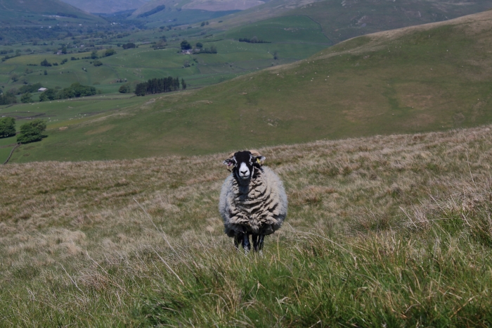
I pulled Wainwright’s book from my bag and checked the route. I turned left and followed the footpath along the wall, passing a flock of sheep enjoying the shade provided by a copse of trees and looking very annoyed at me for disturbing their rest.
I reached the point where I had slipped and twisted my knee on my last visit – the ground was thankfull dry and solid under my feet this time – and climbed up steadily. In his book ‘Walks in Limestone Country,’ Wainwright mentions the Three Peaks Challenge and ‘those whose main object in walking is pleasure and to climb hills for their intrinsic merit.’ As a walker, I most certainly fall under that description and I have no interest in flogging myself to death in order to conquer a hill or peak. With that in mind, Winder is the perfect hill for me. I like to take my time and stop for photographs (far more often than is healthy, I’m sure) and to enjoy the views. After the last time I attempted to climb this fell, I was perhaps overly mindful of my knees and every twinge had me worried that I was going to have to turn back yet again.
Not that I’m paranoid, or anything.

Reaching the top of the ridge that the the path follows to the summit, I stopped and stared for what could have been hours for all the notice I took of time.
The view of the further summits was beautiful. The slopes curved gracefully to rounded peaks covered in spring grass and tan patches where, come the autumn, bracken and gorse would sprout and provide food for the flocks of sheep left to roam freely as they please. These are not the sharp, limestone scars and crags of the Yorkshire Dales – beautiful in their own way – but rolling hills that look as if they had been hand-turned on a giant potter’s wheel and set upside down after being fired in the kiln.

It was a long time before I even thought to take a picture, though even with my lens zoomed right out, the camera doesn’t quite do it justice. This is one of those views that you, dear reader, really must see for yourself.
It was at this point that I took a break to eat a packet of crisps. I needed the energy.
The ridge that I mentioned is like the backbone of Winder and I followed it, trying to ignore just how steep it looked. I’m not the fittest of people and, I will admit, looking at the path ahead I began to get that sinking feeling. Would I have the energy to make it to to the top or would I have to go back, defeated once again?
Well, the great news was that the steepness was deceptive. Once I started climbing, I found the ascent was relatively gentle and it wasn’t long before I could see the small white column of the OS beacon on the summit. It was only a short climb and I began to find fresh reserves of energy – perhaps I didn’t need that packet of crisps after all – as the wind fell away long enough for me to hear the impossible quiet up on the slopes. I was left with nothing but the sounds of distant sheep and my own boots crunching on dried grass and my steady breathing that now seemed unnaturally loud up on the slopes where there was little sign of life.
Wait, was that a horse?
Sure enough, looking at a distant slope I beheld a grey-black horse cropping grass at its leisure, apparently oblivious to the frustrated photographer who couldn’t zoom in close enough to take a decent picture.
The horse disappeared behind a ridge and I carried on walking, though somewhat bemused. What in the world was a horse doing half-way up Winder? As it happens, Wainwright mentions that ‘the peculiar joy of the Howgills is the fell ponies, which wander as they fancy: delightful creatures with flowing manes and tails, usually brown in colour but often piebald.’ Serves me right for buying a book and just looking at the pictures.
And so I plodded on, excitment growing as I neared the summit and the day’s goal. I don’t like leaving things unfinished, especially when I have no control over the circumstances that force me to abandon something I’ve started. Thankfully my knees were no trouble and I slapped my hand down in triumph on the top of the OS beacon that crowns the summit of Winder. There is a similar beacon on every peak in the Howgills, their distinctive white paint making them easy to spot from a distance. I couldn’t help noticing that the paint on the Winder beacon looked remarkably unweathered and, based on how long they’ve been up there, it’s obvious that someone actually climbs these fells on a regular basis to touch up the paint.
Everyone’s got to have a hobby, I suppose.


I sat in the shadow of the beacon and ate the egg and cress sandwiches I had bought in the town before starting my walk. It was about half-past twelve and the climb had taken a little over an hour. Not bad considering how often I had stopped to take photos and to catch my breath. From where I sat slapping at the flies that had begun to plague me (what did they eat when they couldn’t get photographer?) I looked across the slopes to the summit of Arant Haw. I would join Wainwright’s preferred path to that summit and follow it on my way down. For now, though, I thought about how close Arant Haw appeared and how tempting it was to extend my walk a little further and bag two summits in one day. That thought made up my mind for me. I’m not in the habit of climbing a peak just to brag about the achievement, but for the challenge of the undertaking and the enjoyment of the scenery. Arant Haw, tempting as it looked, would wait for another day.

My lunch finished, I scrambled to my feet just as the roar of jet engines broke the tranquility and I jabbed my finger down on the shutter release of my camera as an RAF Typhoon flew low over the fells. I waved, though there was no chance the pilot would see me, and packed up the rubbish from my lunch.

From the summit there were three options for the descent. I could go back the way I had come (safe and boring); there was the route I had planned to take on my first attempt, though the shortness of this path was outweighed by the steepness of the descent; and finally there was the path indicated on Wainwright’s map. It was still a steep climb down, albeit nowhere near as steep as the second option, but the footing was easy and the views were most certainly worth it.

Following the path down, I felt a certain disappointment that I had not carried on towards Arant Haw, but weighing this up against how good I felt to have finally achieved my initial goal, my disappointment faded along with the few whisps of cloud blown by the wind across the sky. Afterall, Sedbergh is only an hour’s drive from home and now that I knew the paths a little better, a return trip would be all the more enjoyable for not being rushed.

The path curved round the side of the fell and followed along most of its length, running parallel with the high street until it finally met the path I had followed for the ascent. The full circle made, I descended into town to grab a drink and to browse in the various bookshops. The sun had shone all day and, despite the stiff breeze blowing, the temperature had been blissfully hot and it was the kind of day that no one could feel miserable on. Back on Howgill Lane, I had a chat with a man carrying a well-used strimmer.
“Been up on the fells?” he asked.
“Yes, I’ve just climbed Winder,” I said, making sure I pronounced the name correctly (Wainwright makes the point that it should be pronounced the way Eliza Doolittle would say window ‘pre-Higgins’).
“Ah, well, now then, now then, did y’see Blackpool Tower?”
“No, I couldn’t.”
“Ah, well, now then. If it’s a clear day, I been told y’can see all the way too Blackpool Tower.”
I don’t know about Blackpool Tower, but from The Calf, the highest point in the Howgills, it’s supposed to be possible to see all the way to Morcambe Bay on the West Coast. I’m sorry, dear reader, but I think you’re going to be coming back to these fells with me on more than one occasion.

I spent a little time in some of the book shops, bought a book by German photographer Alfred Eisenstaedt (the ‘father of photojournalism’ who took the famous photo of the sailor kissing the nurse in Times Square on VJ Day) and made my weary way back to the car and singed my fingertips on the boiling hot steering wheel.
I headed for home with the windows down and the stereo blaring as Jimi Hendrix pleaded with the sheep of the Dales to let him stand next to their fire. Going by the expression on their faces, it wasn’t going to happen.

Wonderful, as if we were there with you. 😍
LikeLiked by 1 person
Thank you!
LikeLike
Excellent. But I suspect you knew that…
>
LikeLiked by 1 person
Thank you! 😁
LikeLike